Sunday 26 January 2014

Henry Moubray Cadell Collection. Photos from four continents.

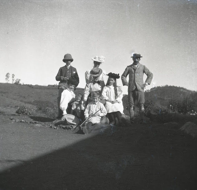
Cadell family(?) in India
BGS Image ID: P769129
Cadell family(?) in India

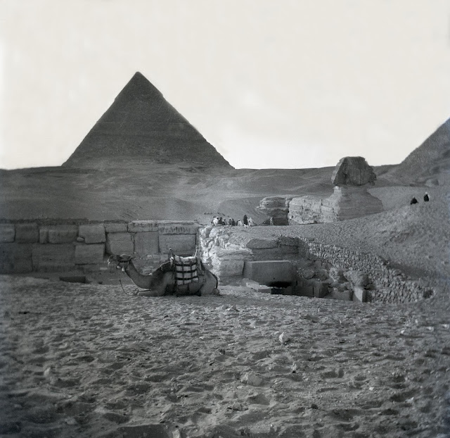
Pyramids and Sphinx of Egypt
BGS Image ID: P768981
Pyramids and Sphinx of Egypt

Yosemite, in the United States of America
BGS Image ID: P768923
Yosemite, in the United States of America

Tsar Bell, Kremlin, Russia
BGS Image ID: P768832
Tsar Bell, Kremlin, Russia

Henry Moubray Cadell of Grange, FRSE (1860-1934) was a Scottish geologist and geographer.  He is known for his experiments in mountain building.The British Geological Survey holds his notebooks relating to the experiments and recreates the squeeze box experiments every year at the BGS Open Day in September. He is also known for his work on the Moine Thrust and the oli shales of the Lothians.

The British Geological Survey holds Cadell's extensive photograph collection. All are now available on Geoscenic.

Bob McIntosh

Sunday 19 January 2014

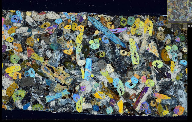
Rock thin sections from the Lugar Sill, Ayrshire.


BGS Thin section number: N10550. Lugar Drill Hole No.3, N bank of Glenmuir Water just up stream with Bellow Water, depth: from 18.8 inch section to 12ft 1 inches.

BGS Thin section number: N10550. Lugar Drill Hole No.3, N bank of Glenmuir Water just up stream with Bellow Water, depth: from 18.8 inch section to 12ft 1 inches. 


BGS Thin section number: N10554. Lugar Drill Hole No.3, N bank of Glenmuir Water just up stream with Bellow Water, depth: from 12.8 inch section to 14ft 1 inches.

BGS Thin section number: N10554. Lugar Drill Hole No.3, N bank of Glenmuir Water just up stream with Bellow Water, depth: from 12.8 inch section to 14ft 1 inches. 


The petrological thin sections (microscope slides) are being digitally photographed (plane and cross polarized light) and progressively linked to the database. Currently about 110,000 Scottish thin sections are available (220,000 images) (S & N registration series). The English collection is currently being captured and the first images will be available on Britrocks during 2014. To view others in the collection visit Britrocks, the British Geological Survey online catalogue of rock and mineral samples.

To see how the images have been captured by our team of volunteers visit this blog post on Geoblogy by Isla Simmons and Rachel Whitty.

Bob McIntosh


Thursday 9 January 2014

Long Churn Cave, Leeds Cave Club, 1931. H.W. Haywood Collection.

Sample images from the H.W. Haywood Collection, Leeds Caving Club 1928-1934

Leeds Cave Club outside entrance. Long Churn Cave, 1931.
BGS Image ID:  P617430
Leeds Cave Club outside entrance. Long Churn Cave, 1931.

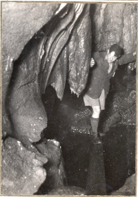
 The traverse pool and plank pool. Long Churn Cave. H.W. Haywood Collection
BGS Image ID:  P617445
 The traverse pool and plank pool.


Descent of Long Churn chimney. Long Churn Cave. H.W. Haywood Collection
BGS Image ID:  P617476
Descent of Long Churn chimney.


Plan of Long Churn Cave with Diccan and Alum Pots H.W. Haywood Collection. Leeds Cave Club.
BGS Image ID:  P617588
Plan of Long Churn Cave with Diccan and Alum Pots

Photographs from the H.W. Haywood Collection held at the British Geological Survey.

A collection of photographs depicting cave exploration and related activities in the Yorkshire Dales area by the Leeds Cave Club in the early 1930s and taken by Harold Wadsworth Haywood FRPS was donated to the Geological Survey of Great Britain Library by Miss Haywood in 1935. The collection consists of two large albums containing a total of 460 separate photographs. There are also twenty-six pages of typescript notes, a bibliography and nine pages of hand-drawn maps and sections illustrating the Alum Pot area and its caves, all produced by Eli Simpson.

The dates of the photographs range from 1928-1934. The images cover the Yorkshire Dales and adjacent areas of Lancashire and Westmorland in the west. They include surface photographs of the caves and karst features, many spectacular underground shots of the caves and their formations, and pictures of members of the Leeds Cave Club, exploring the caves and carrying out a variety of other activities on the surface.

Website for the Haywood Collection

Images on Geoscenic

Publications

Nixon, Gill. 2007 Cave and karst images: the rediscovery of an important historical record. Cave and Karst Science : Transactions of the British Cave Research Association, 33 (2). 87-88.   Download PDF

Nixon, Gillian; Lowe, David; McIntosh, Robert. 2008 The Harold Wadsworth Haywood collection of early caving photographs. [Poster] In: 19th Cave Science Symposium, Loughborough University, 8th March 2008.  Download PDF

Bob McIntosh

Tuesday 7 January 2014

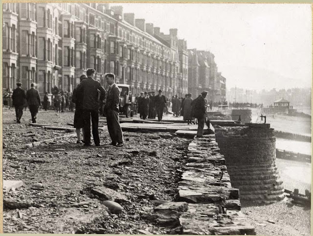
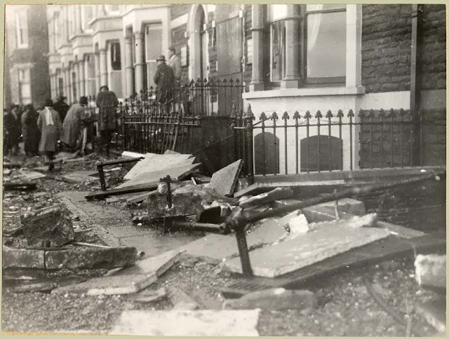
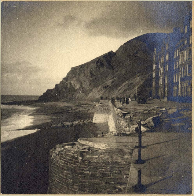
Aberystwyth and Borth, storm damage 28th October,1927.

Images from the British Association for the Advancement of Science Photograph Collection held at the British Geological Survey. 

Storm damage North end of Marine Terrace, Aberystwyth, 1927.
BGS Image ID: P252857 
North end of Marine Terrace, Aberystwyth
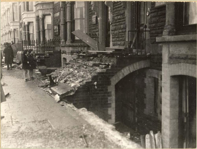

Storm damage North end of Marine Terrace, Aberystwyth, 1927.
  • BGS Image ID: P252858 
North end of Marine Terrace, Aberystwyth


Storm damage North end of Marine Terrace, Aberystwyth, 1927.
  • BGS Image ID: P252859
North end of Marine Terrace, Aberystwyth


Storm damage North end of Marine Terrace, Aberystwyth, 1927.
  • BGS Image ID: P252860
North end of Marine Terrace, Aberystwyth


Storm damage North end of Marine Terrace, Aberystwyth, 1927.
  • BGS Image ID: P252861
North end of Marine Terrace, Aberystwyth


Storm damage North end of Marine Terrace, Aberystwyth, 1927.
BGS Image ID: P252862

North end of Marine Terrace, Aberystwyth
Storm damage North end of Marine Terrace, Aberystwyth, 1927.
  • BGS Image ID: P252863
North end of Marine Terrace, Aberystwyth


Storm damage south Marine Terrace, Aberystwyth, 1927.
  • BGS Image ID: P252864
South Marine Terrace, Aberystwyth


  • BGS Image ID: P252865
Borth, North of Aberystwyth


  • BGS Image ID: P252866 
Borth, North of Aberystwyth


Storm damage North end of Marine Terrace, Aberystwyth, 1927.
  • BGS Image ID: P252867
North end of Marine Terrace, Aberystwyth


Storm damage North end of Marine Terrace, Aberystwyth, 1927.
  • BGS Image ID: P252868
North end of Marine Terrace, Aberystwyth


Storm damage North end of Marine Terrace, Aberystwyth, 1927.
  • BGS Image ID: P252869
North end of Marine Terrace, Aberystwyth


Storm damage North end of Marine Terrace, Aberystwyth, 1927.
  • BGS Image ID: P252870 
North end of Marine Terrace, Aberystwyth

Victoria Terrace, Aberystwyth. Storm damage 15th January 1938.

Victoria Terrace, Aberystwyth. Effect of gale of Jan. 15, 1938.
BGS Image ID: P257998

Aberystwyth storm aftermath of 1938 recorded by British Pathe (From BBC)

 
Bob McIntosh

Sunday 5 January 2014

Swildon's Hole, Priddy, Mendip Hills, Somerset.1921.


Tratman's Temple, Swildon's Hole, cave near Priddy, Mendips, Somerset.1921.
BGS Image ID: P249907
Tratman's Temple 

Barnes Loop. Tratman's Temple, Swildon's Hole, cave near Priddy, Mendips, Somerset.1921.
BGS Image ID: P249908
Barnes Loop

The White Way through Barnes Loop. Swildon's Hole, cave near Priddy, Mendips, Somerset.1921.
BGS Image ID: P249905
The White Way through Barnes Loop

Slender stalagmite pillars. Swildon's Hole, cave near Priddy, Mendips, Somerset.1921.
BGS Image ID: P249906
Slender stalagmite pillars [Tratman's Temple]

Images from the British Association for the Advancement of Science photograph collection held at the British Geological Survey.

Photographs were taken by J.Harry Savory in 1921. A brief account of the cave exploration at this time can be found in the recent book: Irwin, D., Moody, A., Farrant, A. Swildon's Hole: 100 years of exploration. Published by the Wessex Cave Club, 2007.

Bob McIntosh